top of page

Satellites View
Satellite Observations around the world via Earth Observatory byt The NASA

Satellite View

The fire maps show the locations of actively burning fires around the world on a monthly basis, based on observations from the Moderate Resolution Imaging Spectroradiometer (MODIS) on MASA's Terra Satellite.
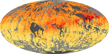
The carbon monoxide maps show the monthly averages of carbon monoxide at an altitude of about 12,000 feet, based on data from the MOPITT sensor on NASA’s Terra satellite.
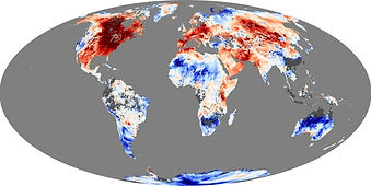
The maps show daytime land surface temperature anomalies for a given month compared to the average conditions during that period between 2000-2008.
bottom of page